United States 1820 – Souvenir Series

$16.00
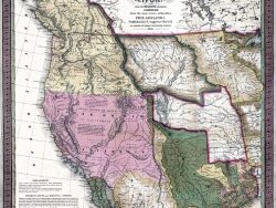
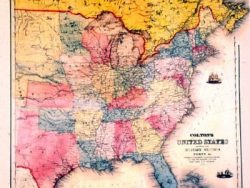
This version of John Melish’s multi-sheet map published a year earlier provides a wealth of detail about the new nation and its near neighbors. The eastern part of the United States and adjoining portions of Canada are mapped in great detail and show main highways as well as scores of towns and cities. Mexico, still controlled by Spain, extends far north into unexplored territory. For Missouri Territory and the Northwest, Melish drew on the latest information supplied by Lewis and Clark. Colored boundaries in two tones add to the appeal of this important map.
Size: 14 x 21 1/4 inches – Color, Text-Weight Paper