Texas 1834 – Souvenir Series

$16.00
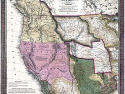
David H. Burr produced this colorful map of Texas two years before the Republic was formed. This edition makes corrections to his 1833 version to demonstrate the land grants made to new settlers. In the lower left corner is the “Plan of the Port of Galveston, made by order of the Mexican Government, by Alexander Thompson, of the Mexican Navy, in 1828,” one of the earliest depictions of that community.
Size: 14 3/4 x 18 inches. Color, Text-Weight Paper
You may also like…
-
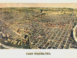
Forth Worth, Texas 1891 – Souvenir Series
$16.00 Add to cart -
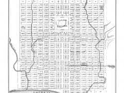
Austin, Texas 1872
$32.50 Add to cart -
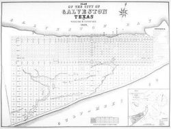
Galveston, Texas 1845
$35.00 Add to cart -
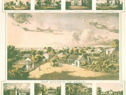
San Antonio, Texas 1852 – Souvenir Series
$16.00 Add to cart -
Western United States 1846 – Souvenir Series
$16.00 Add to cart -
Houston 1891 – Souvenir Series
$16.00 Add to cart