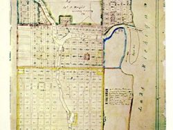
Michigan 1835 – Souvenir Series

$16.00
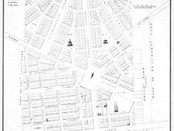
J. Wightman published this folding map of Michigan Territory, then consisting of the lower peninsula, in New York City for settlers making the journey westward. Michigan’s Constitution was adopted in 1835, although it would be another two years before Congressional recognition allowed the state to enter the Union. The map shows the location of towns, Indian villages, forts, roads, rivers, lakes; all necessary information for the traveler. The inhabited parts of Ohio, Indiana, Illinois and Wisconsin are also included.
Size: 15 1/8 x 18 5/8 inches. Color, Text-Weight Paper
You may also like…
-

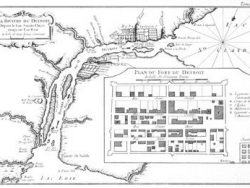
Detroit 1807
$32.50 Add to cart -

Chicago 1779-1857 – Souvenir Series
$16.00 Add to cart -
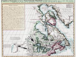
Canada 1719 – Souvenir Series
$16.00 Add to cart -
Chicago 1834 – Souvenir Series
$16.00 Add to cart -
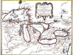
Great Lakes 1755 – Souvenir Series
$16.00 Add to cart -
Detroit 1764
$32.50 Add to cart -
Detroit 1830
$32.50 Add to cart