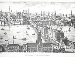
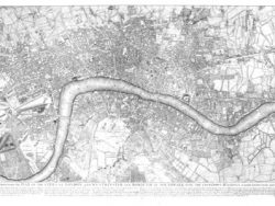
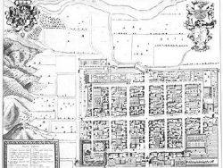
London 1746

$900.00
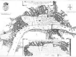
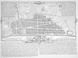
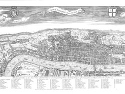
John Rocque’s magnificently detailed plan in 24 sheets; when trimmed and assembled it is approximately seven feet high by thirteen feet long. An invaluable record of Georgian London and a masterpiece of the engraver’s art. The map is accompanied by a key map.
Formally titled A plan of the cities of London and Westminster, and borough of Southwark, Rocque’s map, engraved by John Pine, was drawn at a scale of 26 inches to a mile. It was financed by subscription and took ten years to survey, engrave, and publish. Its large size allowed Rocque to include internal details of some buildings, such as St. Paul’s Cathedral. The close use of lines and hatching were used to distinguish buildings, gardens, fields, and woods. There are magnificent Baroque cartouches and the map is pictorially decorated with trees in the woods and boats on the Thames. It is the most detailed map of eighteenth century London with over 5000 street and place names included. The plan rewards close study and its beauty invites display.
Size: 18 3/4 x 26 3/4 inches per sheet (does not include margin), 24 sheets total. 7 x 13 feet when joined. Cover-stock Paper