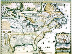
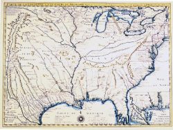
Great Lakes 1755 – Souvenir Series

$20.00
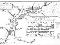
By the middle of the eighteenth century French explorers had mapped the Great Lakes and adjoining region in astonishing detail and with substantial accuracy. Their findings are recorded on this appealing map by Bellin in the version published in Nuremberg by the Homann heirs.
Size: 15 x 19 inches. Color, Text-Weight paper
You may also like…
-
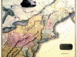
Northern United States 1817 – Souvenir Series
$20.00 Add to cart -
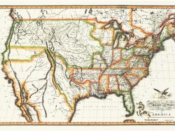
United States 1820 – Souvenir Series
$20.00 Add to cart -
Canada 1719 – Souvenir Series
$20.00 Add to cart -
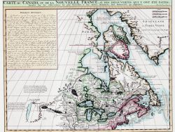
New France 1719 – Souvenir Series
$20.00 Add to cart -
Colonial America 1718 – Souvenir Series
$20.00 Add to cart -
North America 1650 – Souvenir Series
$20.00 Add to cart